Skip to main content
Please wait...
Main navigation
Home
Explore
Geographic Origins
Categories
Search
About
Introduction
How to Use this Website
Acknowledgements
Resources
Introduction to “Ornithology in Peale’s Museum”
Du Simitière Sources
Peale Sources
Collection: Pierre Eugène du Simitière
Category: Maps
Reset Search
Displaying 1 - 15 of 25
A plan of the progress of the british army from their landing in Elk river to their taking possession of Philadelphia 26th Sept 1777
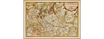
A map of the north East part of Germany
A plan Mss. of the English & Hessian army on Fort Washington done by a Hessian captain
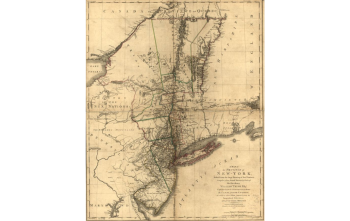
A Map of the province of Newyork, reduced from the large drawing of that province
A map of the counties of Ross & Cromartie
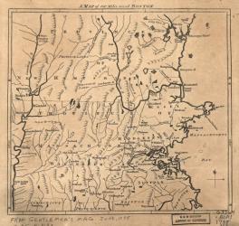
A map of 100 miles round Boston
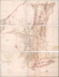
The Map of New York by Saulthier
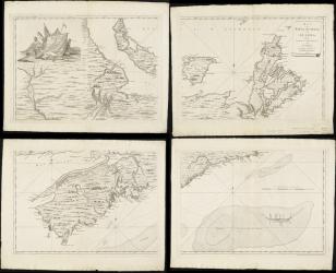
A Map of Nova Scotia or Acadia with the Islands of Cape Breton and St. John
A map of the south East part of Germany
Popple's Map of America, bound
Henry Popple (d. 1743), A map of the British Empire in America with the French and Spanish settlements adjacent thereto (London, 1733)
A map of the armillary sphere
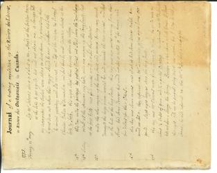
Journal of a Trading Expedition up the Rivière des Livres, or Rivière des Outaiouais in Canada in 1775 and a map of the river
A small French map of the Duchy of Milan
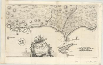
A map of Lima Callao out of the Gentleman's Magazine
A map of the counties of Sussex, Surrey, Kent
Current page
1
Page
2
Next page
››
Last page
Last »
Download CSV
Category
Show all
(28)
Manuscripts
(3)
(-)
Maps
(25)
Geographic Origins
(-)
Show all
(23)
Europe
(16)
North America
(7)
Donor
(-)
Show all
(2)
Dorré, Marie Fidel
(1)
Mercier, John
(1)
Collection
Show all
(-)
Pierre Eugène du Simitière
Category
Show all
(28)
Manuscripts
(3)
(-)
Maps
(25)
Geographic Origins
(-)
Show all
(23)
Europe
(16)
North America
(7)
Donor
(-)
Show all
(2)
Dorré, Marie Fidel
(1)
Mercier, John
(1)
Collection
Show all
(-)
Pierre Eugène du Simitière